
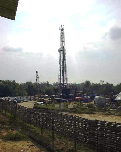
Release: Prospect montage Medco?s Telaga-1 well
Friday, April 11 2003 - 05:31 AM WIB
SUMMARY
The Telaga-1 prospect is a Wildcat exploration well. Located in central Madura Island, Kecamatan Kudundung, Kabupaten Sampang, East Java, and approximately 15 Km to the northwest of the Camplong-1 well.
The primary objective of the Telaga-1 well is to prove the hydrocarbon potential within reef build-up of the Poleng member of the lower Kujung formation and the Prupuh member of the upper Kujung formation.
The secondary objective is the upper and lower Tuban and Tawun formation.
The lower Kujung formation (Poleng member) and the upper Kujung formation (Prupuh member) are suspected as a reef build up with its growth in Paleo High, whereas the Tuban formation is estimated "prograded sand deposits" or turbidites.
HYDROCARBON RESERVES
Total hydrocarbon reserves are estimated at 37.0 MMBO + 167.0 BCFG. The proposed well is estimated to reach a depth of 10,200ft SS eq. 2.250M.
RECOMMENDATION TO DRILL TELAGA-1
The recommendation to drill the well has been based on the following analysis:
1. The presence of reef build up with is predicted to be lower and upper Kujung formation as indicated in seismic as "on lapping" facies into a reef build up. This has been proven.
2. Presence of prograding Sand sequences on seismic stratigraphy, which is predicted to be equivalent to sandstone Ngrayong Member of the Tuban and Tawun formations.
3. Seismic character does not indicate a major tectonic event across the Telaga prospect, which implies that the Telaga area was Paleo Basement High.
4. There is a high area, seen from Anomaly Gravity interpretation.
GEOLOGICAL SETTING
The Telaga prospect lies on the anticline belt along Arosbaya, Konang Tambelengan and Kedundung areas, which suggests a continuance to the East of Madura (Sebaya Prospect). The regional area consists of the sub-basin of the Northeast Java basin, where the Northeast is bounded by the North Madura Platform / Shelf and Central Depression and the Southeast by BD platform or Madura Strait Basin.
* Since late Oligocene to Early Miocene the basin had undergone rapid subsidence, which has resulted in a thick bed of deep marine, claystone siltstone and shales. Nevertheless the zone was a stable area for possible reef growth.
* Structural frame work of the Madura back arc basin was controlled by a regional tectonic event, such as:
(a) NE-SW fault pattern was seen in the central basin and JS-ridge.
(b) E-W fault pattern was recognized as the Sakala Fault System.
The E-W fault system is related to the subduction of Indo Australian toward Eurasia plate.
STRATIGRAPHY
The stratigraphy of the East Java Basin is applied to Stratigraphic succession of Telaga-1. Based on seismic interpretation sequence stratigraphy of the Telaga-1 Well is correlated to Konang-2 Well.
Stratigraphic unit of the Telaga-1 Well can be predicted as follows:
- Tawun Formation (surface 3,750 Ft SS) Middle Miocene. The formation consists of interbedded siltstone, claystone and sandstone, which are interpreted as a sub marine fan deposit.
The thickness of the sandstone layers encountered range in Kertegeneh are from 10- 70 feet, fine to medium grained, white to brownish white, fair to good sorted, porosity and permeability are expected to be poor to fair with carbonate cementation.
- Tuban Formation (3,750 Ft SS 7,400 Ft SS) Early Miocene. Based on geological data from Sebaya-1 and Camplong-1 wells and surface geological outcrops the lithology of the formation consists of interbedded shales, sandstone and limestone.
- Kujung formation (7,400 Ft SS TD) Oligocene. The upper part of the formation consists of predominantly limestone, shales and minor sandstone beds.
- Reef build up of the Prupuh member mostly developed in upper Kujung formation and also in lower part as Poleng member.
STRUCTURE
The primary objective of the Telaga prospect is reef build up which is formed on the Paleo High during tectonic activity in Early Oligocene Early Miocene time. The prospect is bounded to the North and South, which were resulted by divergent wrench activity at the same period.
The secondary objective is a four-way dip closure, which was formed by a late compressional event and later controlled by listric faults.
RESERVOIR ROCK
As described on the previous stratigraphic section the reservoir objective consists of reef build-up within Kujung formation, which has been proven as a productive hydrocarbon reservoir in the North, offshore Madura Island. Reservoir properties have a porosity range of 20% - 30% as indicated by wireline log from the BD-1 well. Additional reservoir objectives are the sandstone of Ngimbang formation proven in East Java.
SOURCE ROCK AND MIGRATION
The potential source rock in this area was derived from transgressive sequence, which has proven to contain organic matter, mixed land plant and marine kerogen.
Shales of the Ngimbang, Kujung and Tuban formations are considered as the main potential source rock. (*)
- CityView Corporation Limited -
